
Please help Lake Stewards of Maine (LSM) track ice-in and ice-out dates for your lake.
- Submit your observations using our Ice Coverage Submission Form .
- For definitions of ice-in and ice-out, see below.
- For information on partial ice cover, visit Winter Ice Variability .
- View current conditions on the Ice Coverage Map .
- Explore trends in our Statewide Ice Cover Summary .
- Our partners at the Maine Department of Agriculture, Conservation and Forestry (Maine Geological Survey) also provide Snowpack Data . In 2026, peak snow water content occurred around March 4.
- Interested in additional climate-related monitoring opportunities? Learn more about the high-elevation lake monitoring project .
How do I determine ice-in and ice-out?
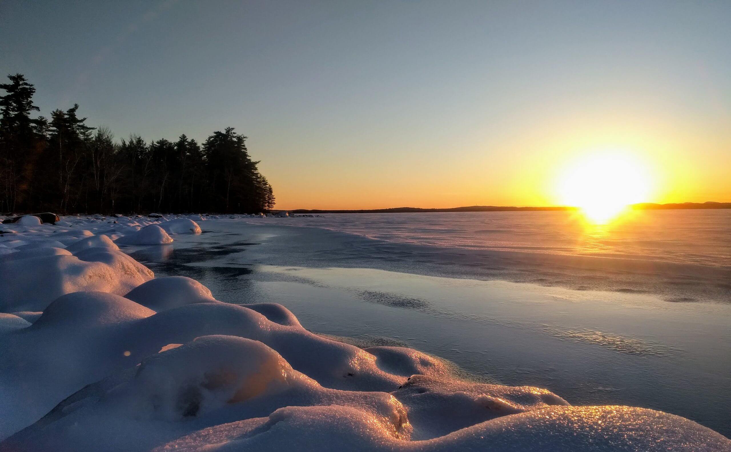
LSM tracks when lakes freeze (ice-in) and when they become ice-free (ice-out). While ice-out has historically been recorded, tracking ice duration is increasingly important for understanding changing climate conditions.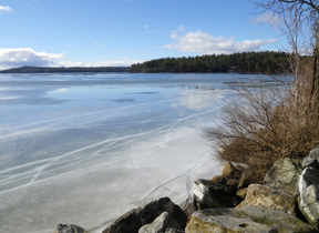 Ice-out is declared when a lake becomes navigable or mostly ice-free. Methods vary by lake:
- Complete ice disappearance
- Main basin becomes ice-free
- Approx. 80% of ice cover is gone
- First ice-in event
- Final, sustained ice cover
Recommended Methods for Tracking Ice-Out
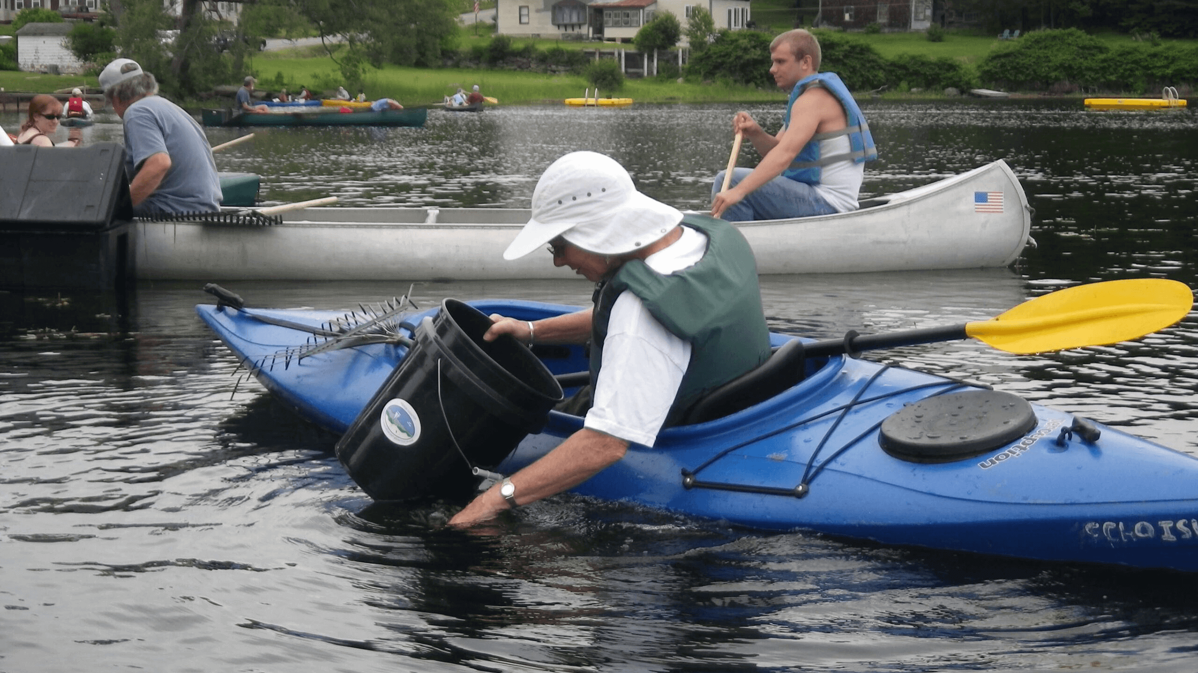
Consistency is critical. If your lake already has a method, continue using it. If not, consider the following approaches:1. Use Multiple Observers
Create a small group responsible for observations. This ensures continuity and reduces the chance of missed events.2. Establish a Photo Station
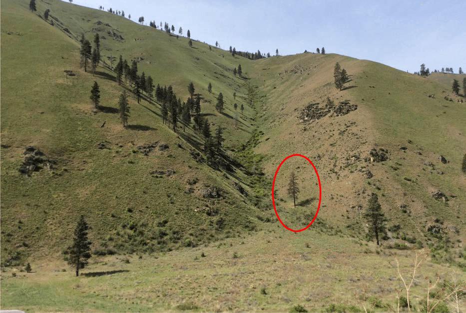
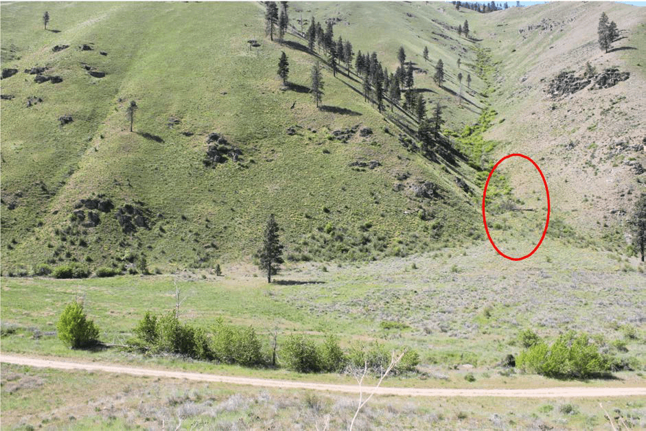
A photo station provides a fixed viewpoint to document changes over time. This helps create consistent, comparable records year to year. Photo stations can be simple (e.g., a marked post) or more permanent structures. The key is a stable, repeatable view that will not be disturbed. Additional resources: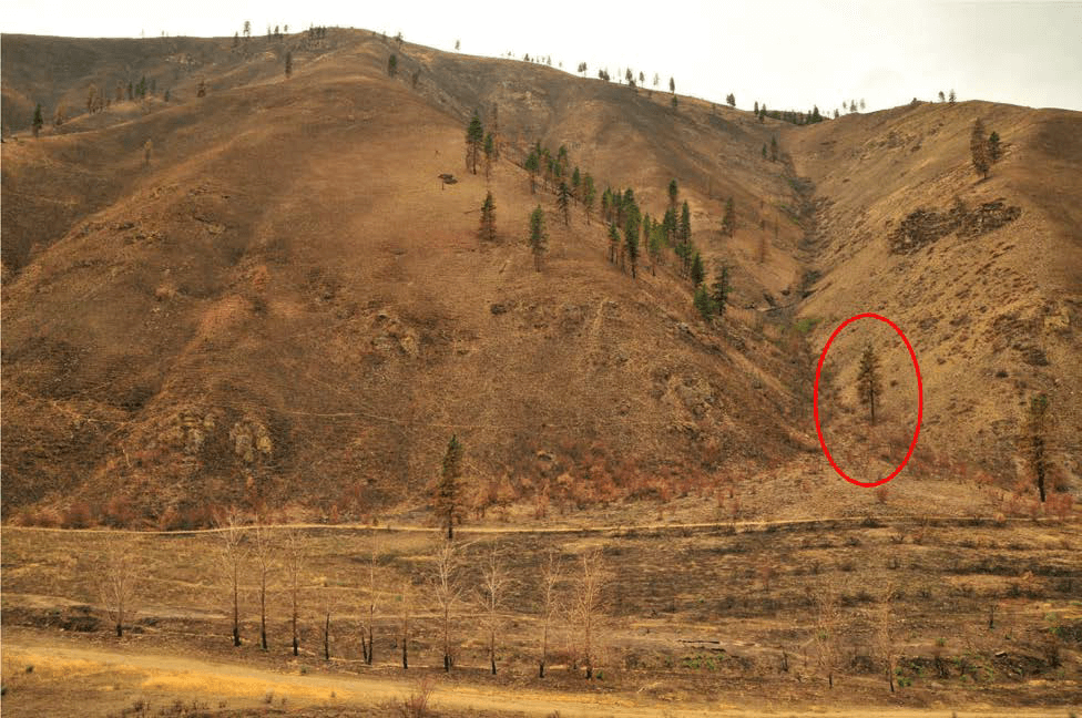
The Story of Maine’s Lake Ice Cover
The Story of Maine’s Lake Ice Cover If you are getting an error message or the page does not seem to be loading, please disable your adblocker or you can view the report HERE. Thank

Ice Variability
Ice Variability Quick Links 01/09/2023 Severe temperature fluctuations are a well-recognized potential impact of human-caused climate change.1,2 The warming climate exacerbates the volatility of weather leading to less stability in a season. Over the past
Ice-In & Ice-Out Tracking Map
Ice-In & Ice-Out Tracking Map Quick Links Ice-In & Ice-Out Tracking Please help the Lake Stewards of Maine (LSM) track ice-in and ice-out dates for your lake! The map below displays data that has been
Ice-In & Ice-Out Tracking Form
Ice-In & Ice-Out Tracking Form Quick Links Ice-In & Ice-Out Tracking Please help the Lake Stewards of Maine (LSM) track ice-in and ice-out dates for your lake! Using the form below you can submit
Volunteer Time Tracking Form
Volunteer Time Tracking Form Quick Links Attention LSM volunteers please complete this form providing us with your hours dedicated to monitoring and lake stewardship activities this past year. This information helps us determine volunteer value
Maine Lake Data
Maine Lake Data Quick Links Lake Stewards of Maine (LSM) trains volunteers to collect many types of data related to lake health. In addition, LSM collects and catalogs data from other organizations, such as the